Tracking down London’s Roman roads
The Romans are famous for the straight, hard-surfaced roads they built all across their empire. In London, a network of roads radiated from the city, and some modern streets still follow the same path.
Across London
43–410 CE
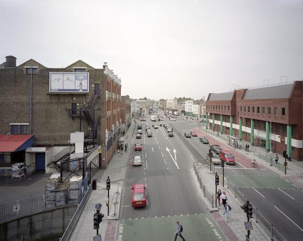
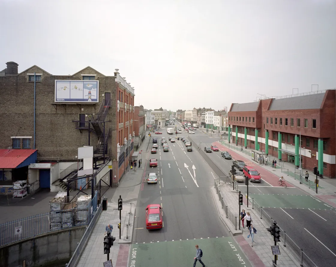
The noticeably straight A10 mirrors Ermine Street, a Roman road, on its way north from the City of London.
A Roman road revolution
When the Romans arrived in Britain in 43 CE, they didn’t wait to show off their advanced roadbuilding. Within decades, a network of roads spanned the country – vital arteries that could quickly move soldiers, information and goods.
London – which the Romans called Londinium – was the well-connected capital of its province. Major roads radiated outwards to important Roman towns like St Albans, Silchester, Colchester and Canterbury.
These far-reaching roads were impressively straight, with a hard surface and excellent foundations.
They lasted long after the Romans had gone. Even today, 2,000 years later, some modern roads run along the same routes. Some are laid right on top. So, by foot, bike, bus or car, it’s still possible to follow the Romans who went before, down Watling Street, Ermine Street and other ancient routes.
How were Roman roads built?
It typically started with an earth bank known as an ‘agger’. On top of this, the Romans placed layers of stone, sand and gravel.
In Britain, the hard road surface was almost always a layer of gravel or broken stones which had been compacted – a technique called metalling.
Roman roads were cambered, meaning they sloped from the middle to the sides, allowing water to run off.
“Roman roads were never perfectly straight”
Milestones by the side of the road marked out distances. From accounts of Roman journeys, it’s estimated that a carriage could travel 50 miles a day. On foot, a person might walk 35 miles per day. This was much quicker than the tracks used before the Romans arrived.
The Romans recorded the distances between towns to help travellers. A guide to over 200 routes across the empire, known as the Antonine Itinerary, has survived. London crops up in the British section, giving us valuable information.
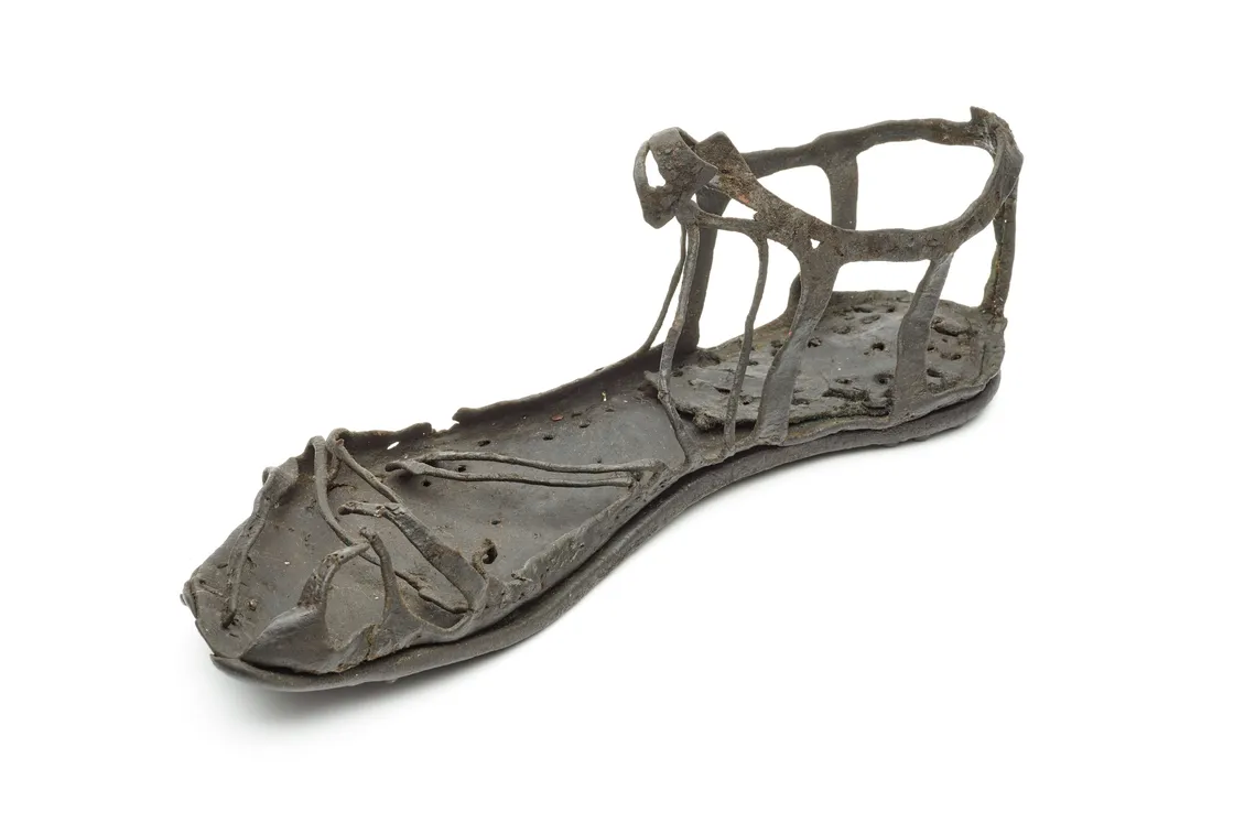
This type of shoe, with its tough hob-nailed sole, was worn by Roman soldiers.
Why were Roman roads straight?
The best reason is that it’s much faster to travel directly between two places. Roman surveyors were very skilled at choosing the right routes for their roads to avoid making too many turns.
But Roman roads were never perfectly straight. They respected the landscape, sometimes following ridges and valleys.
Where a change of direction was needed, straight sections set at angles were preferred over a curve.
Life and death on the road
Along the roads heading out of Roman London, there were small roadside settlements. These had places for travellers to rest, and markets where goods heading into London were bought and sold.
Cemeteries were also placed alongside the roads heading out of London, as Romans traditionally kept burials outside of their towns.
-
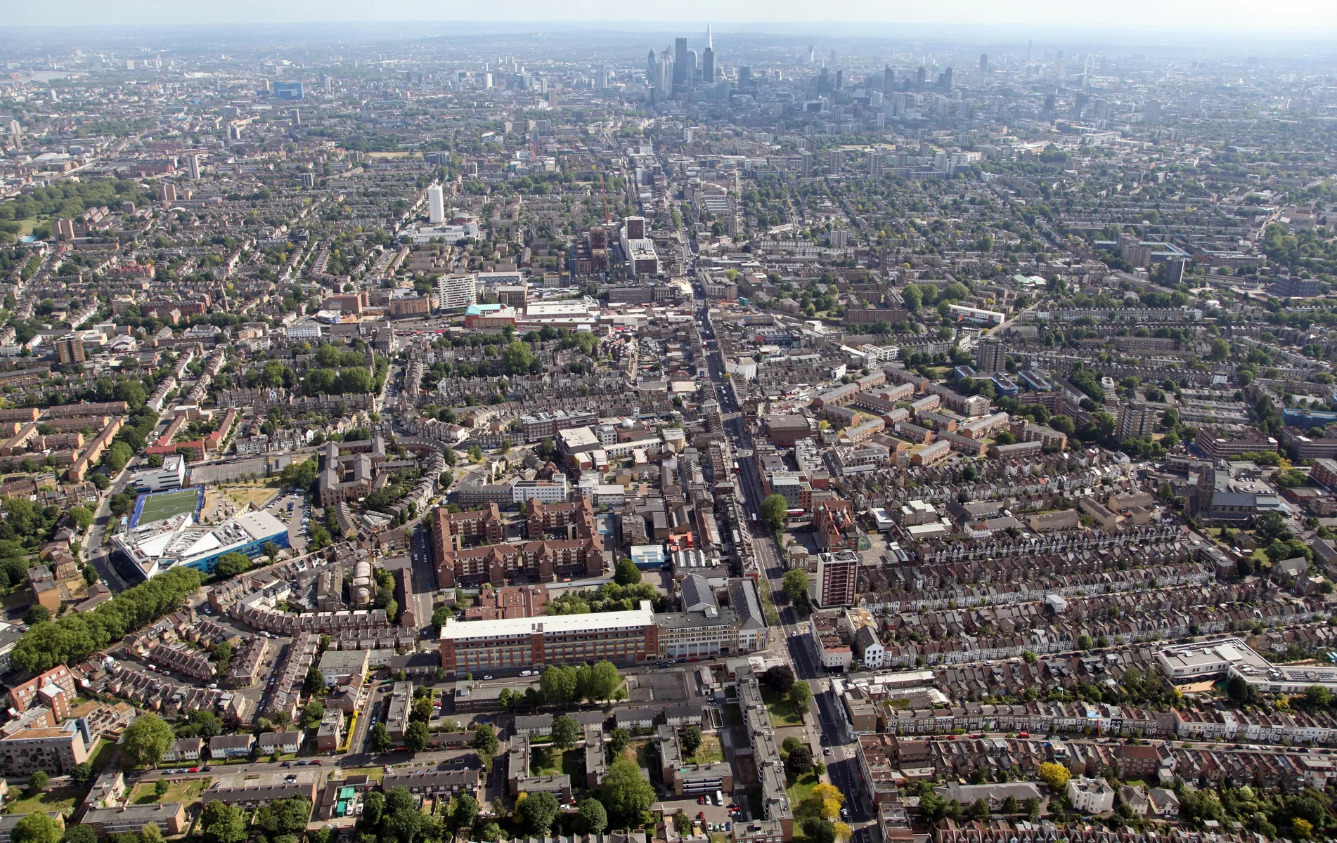
From the grid of streets that covered the City of London, Roman roads radiated outwards, carving out routes still used in today’s road network.
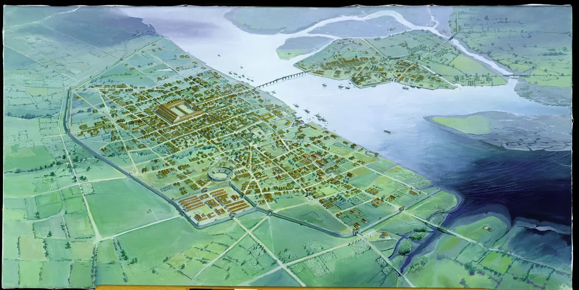
The roads inside Roman London
Within Roman London’s walls, the streets were mapped out in a grid. Many modern streets in the City of London follow similar alignments.
Roads ran between the entry points – Aldgate, Bishopsgate, Aldersgate, Newgate and Ludgate – and the central forum-basilica, Roman London’s most important public building.
An important road headed south from the forum towards the smaller Roman settlement at Southwark, crossing the one bridge over the River Thames. Today, this route would be roughly the same as following Fish Street Hill and Gracechurch Street.
Ermine Street
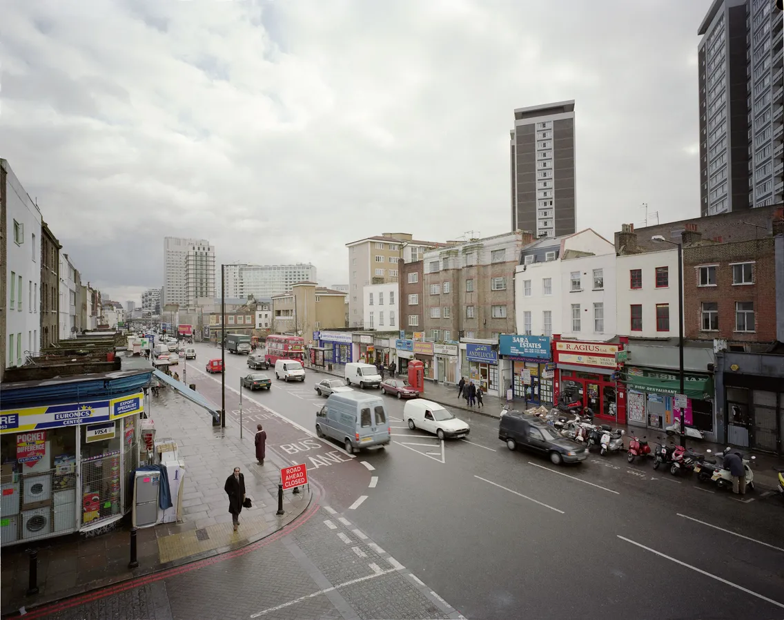
Head north on the A10 from Bishopsgate, on the northern edge of the City of London, and you’ll be tracing the path of the Roman road known as Ermine Street.
Also known as the Great North Road, it followed the almost straight line along modern Shoreditch High Street, Kingsland Road, Stoke Newington High Street, Stamford Hill and Tottenham High Road. It would have then voyaged out besides the River Lea valley towards the Roman settlements at Cambridge, Lincoln and York.
Ermine Street was built in the first few decades after the Roman invasion. Like other Roman roads, it was given its name later, in the early medieval period. We don’t know if the Romans had a name for it.
Watling Street
Watling Street spanned a mind-boggling distance, connecting English Channel ports in Kent with the Roman settlement at Leicester in the East Midlands. It’s not to be confused with the Watling Street in the City of London.
A monumental marble arch marked the road’s start at Richborough in Kent, the place where the Romans first landed in Britain.
As Watling Street approached central London from the south-east, it passed through what’s now Greenwich Park. It’s then thought to have followed roughly the same route as Old Kent Road, in Southwark. In 2024, a section of Roman road was discovered directly underneath it.
Parts of Old Kent Road lie directly above Roman Watling Street.
Watling Street crossed the River Thames just south of modern-day Westminster Bridge. We have no evidence of a Roman bridge there, so it’s likely to have been a shallow crossing point. The road roughly followed the route of Edgware Road, most of which is now the A5, heading north-west to the Roman settlements at St Albans and Wroxeter.
Roadside settlements along Watling Street have been found at Crayford in south-east London and Brockley Hill in north London.
The Silchester road
This road roughly followed the River Thames west of Roman London, remaining a safe distance from the floodplain.
Today, it would trace the line of Oxford Street, Bayswater Road, Notting Hill Gate, Holland Park Avenue and Goldhawk Road before continuing to Brentford, where there was a Roman settlement.
It would then continue through Hounslow on its way to the important Roman town at Silchester in Hampshire. You’ll find some of the defensive walls and an amphitheatre still standing there.
-
Watling Street followed the modern route of Edgware Road and the A5 on its way to St Albans.
-
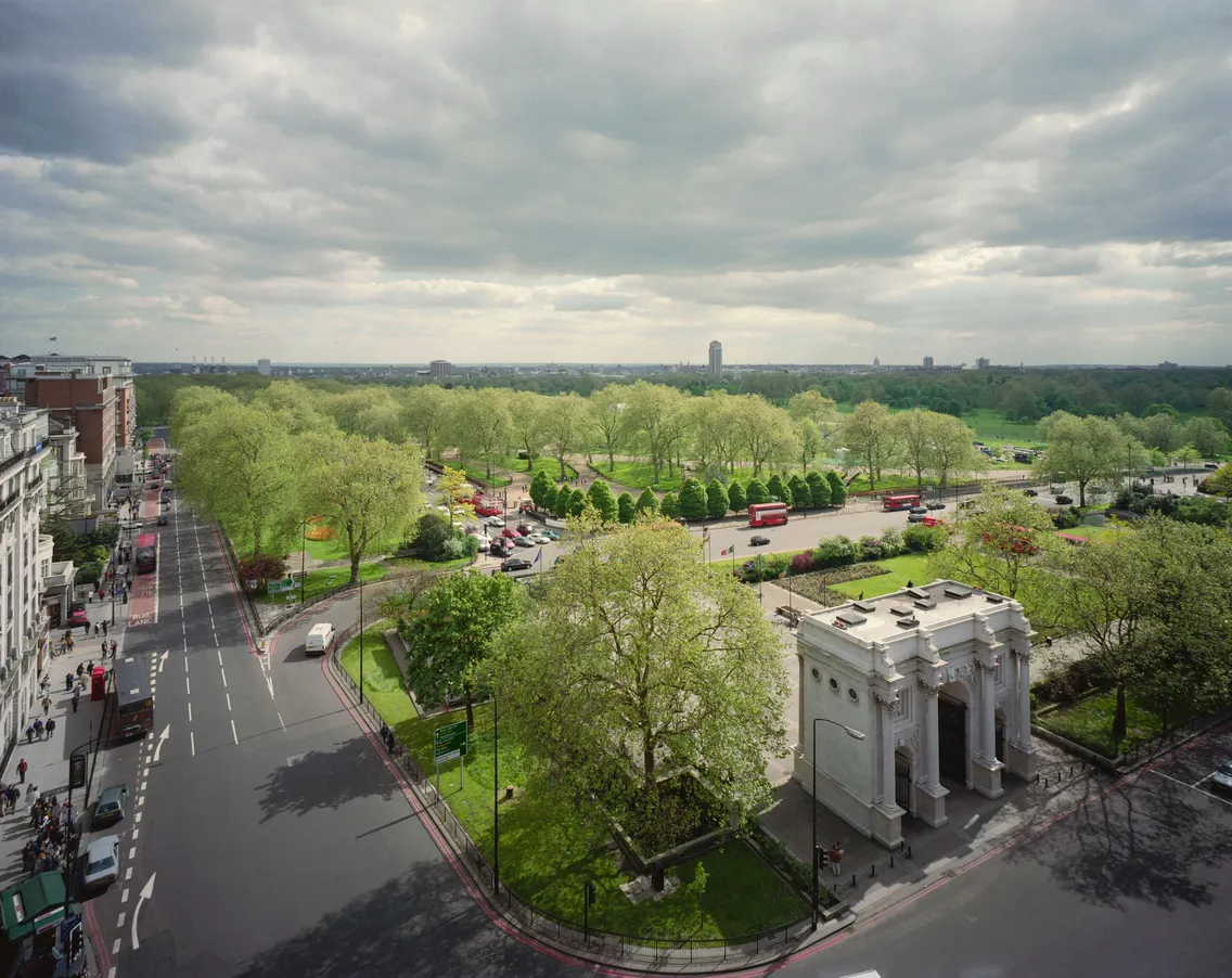
The junction between Watling Street and the Silchester road is thought to be close to Marble Arch, where the A40 meets the A5 today.
The Colchester road
From Aldgate, a Roman road ran north-east to Colchester in Essex, which the Romans chose as their first capital.
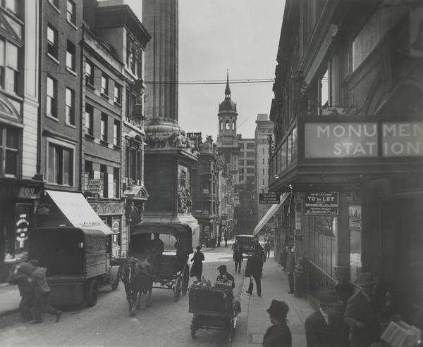
The road crossed the River Lea at Old Ford, now in Tower Hamlets, giving the nearby Roman Road and its famous market their name. If this ancient road still existed today, it would take you through Ilford, Chadwell Heath and Romford.
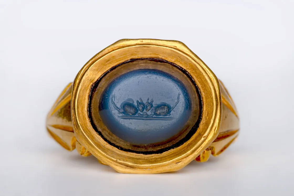
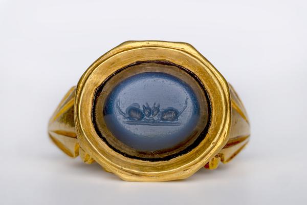
This ring, showing two mice, comes from the roadside Roman settlement at Old Ford.
Stane Street
From London Bridge, this Roman road headed roughly south-west to the Roman settlement at Chichester in West Sussex.
From Elephant and Castle, it followed Kennington Park Road down to Clapham and Tooting. When the road reached Merton, it crossed the River Wandle and went on through Ewell.
Other Roman roads in London
A number of other routes branched off these Roman roads. Just north of Peckham in Southwark, a Roman road left Watling Street to head south past Beckenham, through the Downs and Weald towards Lewes in Sussex.
Another Roman road began around Kennington Park, branching off the Roman Stane Street and heading in the direction of Brighton. This road ran roughly south through what’s now Brixton, Streatham, Thornton Heath and Croydon, where a roadside settlement and coin hoards have been found.
Tags
-
Photography
 Photography
The A107 Cambridge Heath Road, looking east towards Roman Road, Bethnal Green (pigment print)
Davies, John
2001
-
-
Photography
-