John Davies’ photos of major London roads
In 2001, we commissioned landscape photographer John Davies to produce pictures of the capital’s arterial roads for his Metropoli series. The 16 photos capture a moment in time two years before the Congestion Charge began, and show how roads dominate the city’s landscape.
Across London
2001

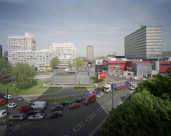
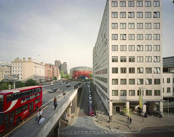
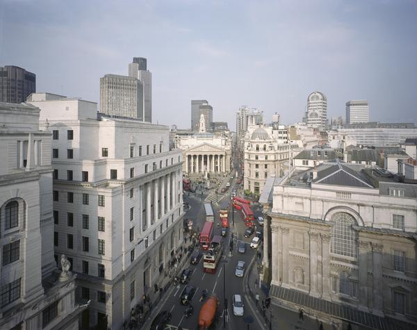
Poultry and Queen Victoria Street
Although landscape photography and painting is traditionally associated with nature, Davies’ photos usually feature man-made structures and urban environments. “People often comment that I don’t include many people in my pictures,” Davies said in a 2006 interview with the National Science and Media Museum in Bradford. “But in fact the content of my work is all about the evidence of people, what people do to the environment we live in.”

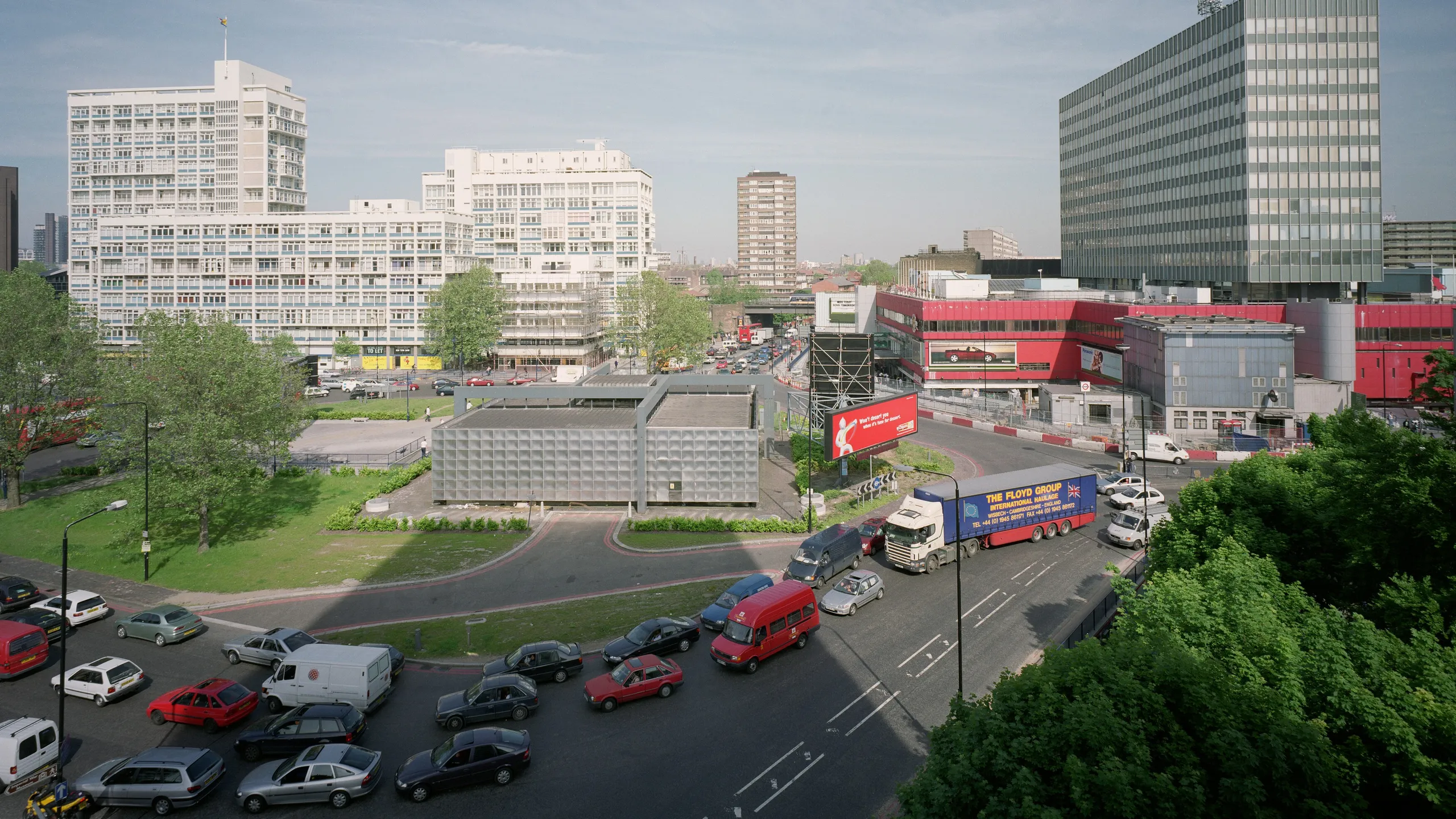
The Hammersmith Flyover
West London’s Hammersmith Flyover was built in 1961 to raise the A4 above street level. In 2011, it was carrying 90,000 vehicles a day. Like all of Davies’ photos, this image is carefully composed to feature interesting shapes and contrasting subjects, while packing in small details that keep you looking.
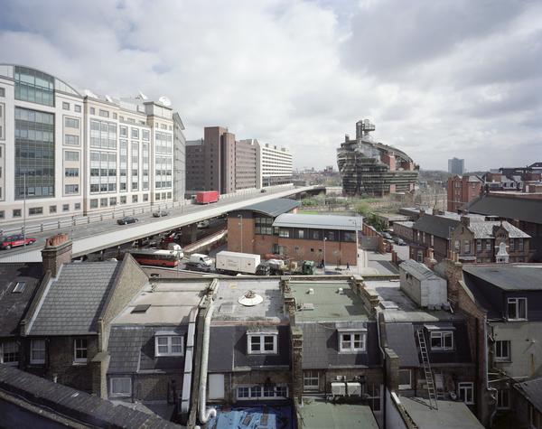
Elephant and Castle
This is the Elephant and Castle roundabout, looking east towards the A201 New Kent Road. Davies’ photos are often taken from an elevated position, finding a new perspective that shows the many layers of a landscape. Here, it reveals the road, surrounding towers and the faraway buildings which stretch to the horizon.

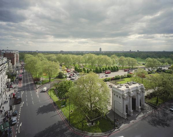
Marble Arch and Hyde Park
Davies’ Metropoli series aimed to investigate Britain’s major cities. “I’ve always been interested in the idea of photographs being like a scientific record,” he said in 2006, “[and] at the same time a way of expressing one’s own concerns about the world.” The road on the left of this photo is the A4202 on the east side of Hyde Park.

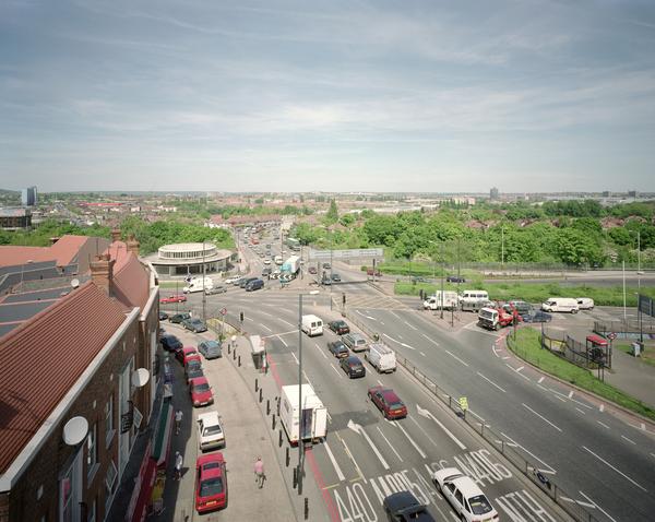
Hanger Lane Gyratory
The A406 North Circular Road at Hanger Lane Gyratory in west London. A gyratory is a type of large, complex roundabout.

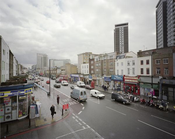
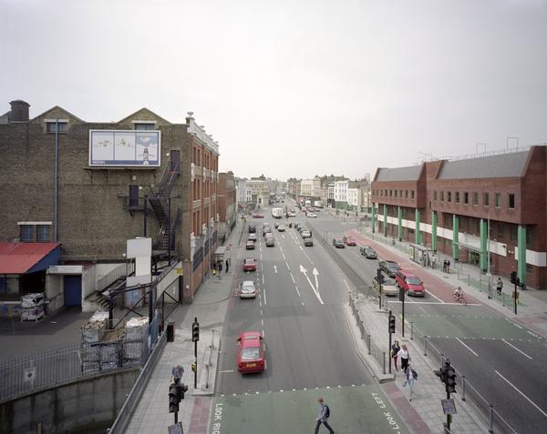
Cambridge Heath Road
This photo was taken by the A201 in east London. It looks east along Roman Road. London’s road traffic changed forever in 2003, two years after this photo was taken, when the central London Congestion Charge was introduced by London’s mayor at the time, Ken Livingstone.

Edgware Road
Under the Congestion Charge, road users are charged for driving vehicles within the congestion zone. The charge successfully increased the use of public transport and cut traffic. It’s also become a tool for reducing air pollution, working alongside the Ultra Low Emission Zone (ULEZ), first introduced in 2019. ULEZ charges the drivers of the most polluting vehicles, and now covers all of London’s boroughs.

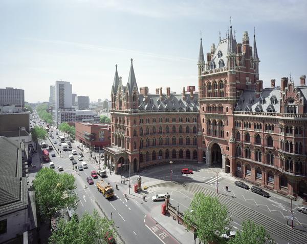
Euston Road
This is the A501 Euston Road, running past the St Pancras London Hotel. This impressive building originally opened as the Midland Grand Hotel in 1873. It was designed to serve the Midland Railways’ St Pancras station nearby, which opened in 1868. The hotel shut in 1935, and the building was set for demolition in the 1960s, before a high-profile campaign saved it. The exterior was restored in the 1990s, and in 2004 planning permission was granted to reopen it as a luxury hotel.

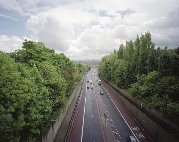
The A1
The A1 is also known as the Great North Road, and connects London to Scotland. This elevated view was taken from Hornsey Lane in north London. It looks south, and you can spot central London’s towers on the horizon.
Tags
-
Photography
 Photography
The junction of Poultry and Queen Victoria Street at Bank, looking east (pigment print)
Davies, John
2001
-
Photography
-
Photography
-
-
-
-
-
-
-