
Library — C. 1600
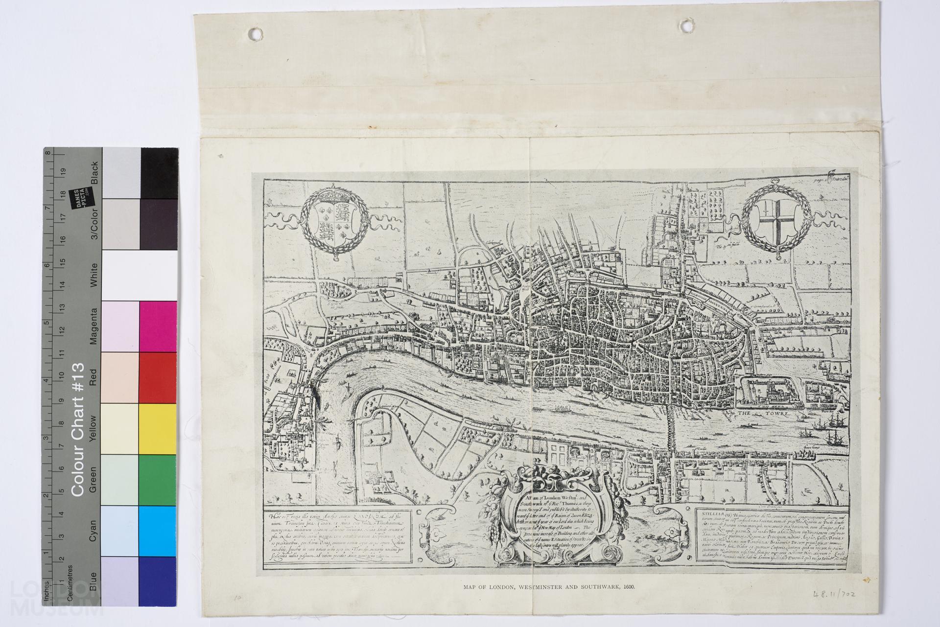
Map of London, Westminster and Southwark, 1600
A map titled ‘Map of London Westminster and Southwark, 1600’, modern photographic reproduction of the original as a survey of the City of London in the reign of Queen Elizabeth. A coat of arms with lions and lilies at the top left corner, and the other with a sword at the top right corner. Prominent locations on the map include ‘The Towre’, London Bridge and ‘The Beare bayting’.
- Category:
- Library
- Object ID:
- 48.11/702
- Object name:
- Map of London, Westminster and Southwark, 1600
- Object type:
- Artist/Maker:
- —
- Related people:
- Related events:
- Related places:
- Production date:
- c. 1600
- Material:
paper, ink
- Measurements/duration:
- H 266 mm, W 300 mm (on mount), H 212 mm, W 298 mm (map) (overall)
- Part of:
- —
- On display:
- —
- Record quality:
- 60%
- Part of this object:
- —
- Owner Status & Credit:
Permanent collection
- Copyright holder:
digital image © London Museum
- Image credit:
- —
- Creative commons usage:
- CC BY-NC 4.0
- License this image:
To license this image for commercial use, please contact the London Museum Picture Library.
Download image file
You are welcome to download and use this image for free under Creative Commons Licence CC BY-NC 4.0.
Credit: London Museum
To licence this image for commercial use please contact the London Museum Picture Library