
Library — 1862
MAP OF LONDON published with CASSELL'S FAMILY PAPER
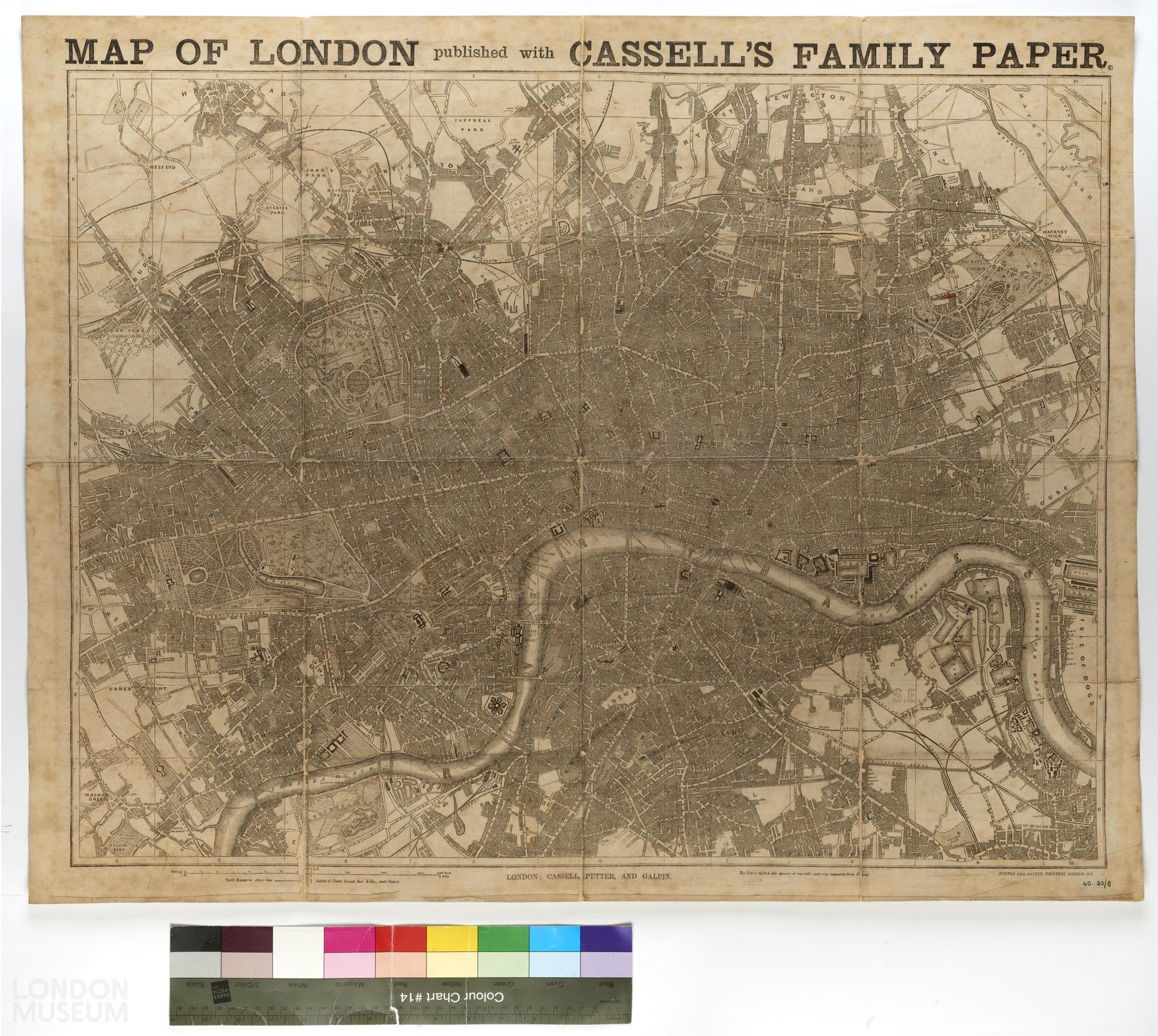
Map of London by Cassell, Petter & Galpin, 1862. Title: 'MAP OF LONDON published with CASSELL'S FAMILY PAPER'. Extent: Stoke Newington, West India Docks, Peckham and Notting Hill. Shows International Exhibition in Cromwell Road. 'Cassell's illustrated family paper' was sold for 1d. to subscribers who presented tickets issued in the previous three issues to their booksellers or newspaper vendors. Register entry: One of 13 late 19th century and early 20th century maps of London.
- Category:
- Library
- Object ID:
- 40.30/8
- Object name:
- MAP OF LONDON published with CASSELL'S FAMILY PAPER
- Object type:
- Artist/Maker:
- Cassell, Petter & Galpin
- Related people:
- Related events:
- Related places:
- Production date:
- 1862
- Material:
paper, linen, ink
- Measurements/duration:
- H 679 mm, W 857 mm (overall)
- Part of:
- —
- On display:
- —
- Record quality:
- 60%
- Part of this object:
- —
- Owner Status & Credit:
Permanent collection
- Copyright holder:
digital image © London Museum
- Image credit:
- —
- Creative commons usage:
- CC BY-NC 4.0
- License this image:
To license this image for commercial use, please contact the London Museum Picture Library.
Download image file
You are welcome to download and use this image for free under Creative Commons Licence CC BY-NC 4.0.
Credit: London Museum
To licence this image for commercial use please contact the London Museum Picture Library