

Library — 1720; c. 1874
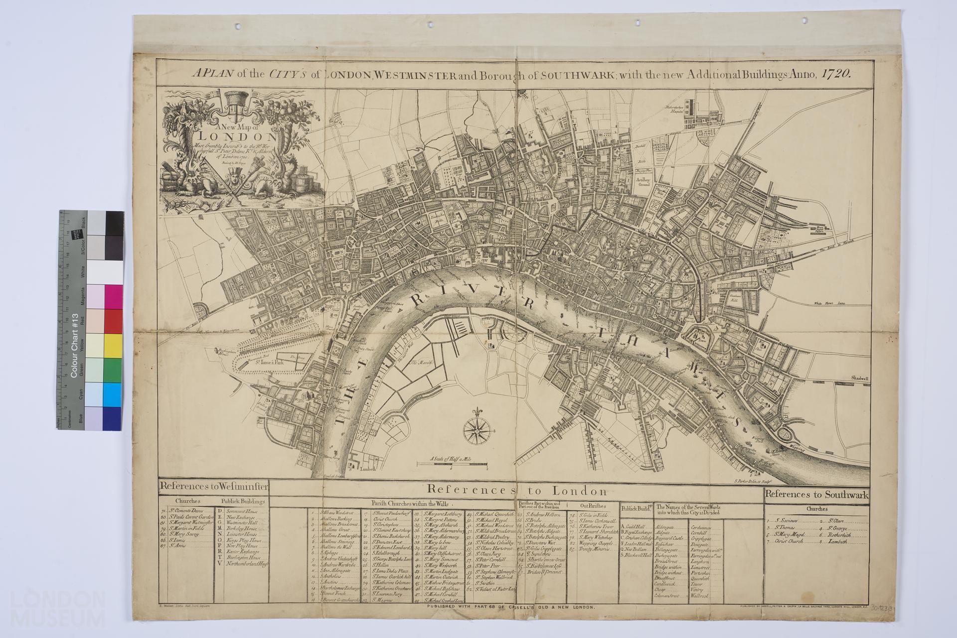
A PLAN OF THE CITY'S of LONDON, WESTMINSTER and Borough of SOUTHWARK with the new Additional Buildings Anno 1720
Facsimile of a plan of London, Westminster and Southwark, AD 1720, by S. Parker, revised by J Senex, engraved by Edward Weller, reprinted in about 1874, published with Part 68 of Cassell’s Old and New London by Cassell, Petter & Galpin. Title: 'A PLAN OF THE CITY'S of LONDON, WESTMINSTER and Borough of SOUTHWARK with the new Additional Buildings Anno 1720'. Extent: New River Head, Whitechapel, Lambeth and Buckingham House. Notes on white label adhered to the melinex sheet read, 'FACSIMILE, FROM 1820, Parker'.
- Category:
- Library
- Object ID:
- 30.123/3
- Object name:
- A PLAN OF THE CITY'S of LONDON, WESTMINSTER and Borough of SOUTHWARK with the new Additional Buildings Anno 1720
- Artist/Maker:
- Parker, S., Weller, Edward, Cassell, Petter & Galpin
- Related people:
- Related events:
- Related places:
- Production date:
- 1720; c. 1874
- Material:
paper, ink, textile (unidentified)
- Measurements/duration:
- H 557 mm, W 705 mm (with suspension strip), H 530 mm, W 705 mm (map) (overall)
- Part of:
- —
- On display:
- —
- Record quality:
- 60%
- Part of this object:
- —
- Owner Status & Credit:
Permanent collection
- Copyright holder:
digital image © London Museum
- Image credit:
- —
- Creative commons usage:
- CC BY-NC 4.0
- License this image:
To license this image for commercial use, please contact the London Museum Picture Library.
Download image file
You are welcome to download and use this image for free under Creative Commons Licence CC BY-NC 4.0.
Credit: London Museum
To licence this image for commercial use please contact the London Museum Picture Library