
Library — 1637
Middlesex olima trinobantibus habitata
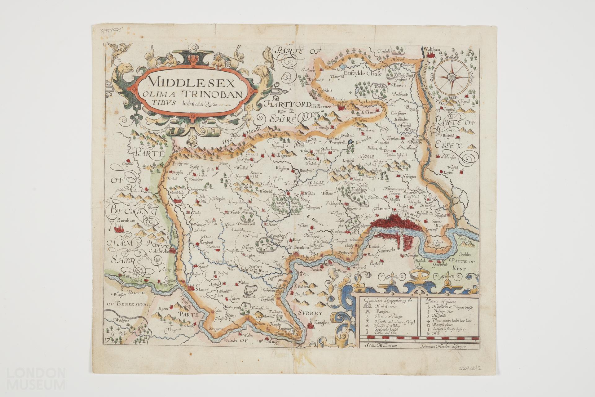
Map titled "Middlesex olim a Trinobantibus habitata" by by John Norden. ("Johannes Norden descripsit"). From William Camden's Britannia (London : A. Crooke, 1637). Imprint derived from the atlas in which this state of the map was first issued. Differs from earlier states by the additions of a compass rose and a plate number, sometime between 1610 and 1622 : numbered 17. Shows county boundaries, rivers, woods, parks, and settlements. Relief shown pictorially. Geographic coverage County of Middlesex. Coloured version of 2007.46/1.
- Category:
- Library
- Object ID:
- 2007.46/2
- Object name:
- Middlesex olima trinobantibus habitata
- Object type:
- Artist/Maker:
- Norden, John
- Related people:
- Related events:
- Related places:
- Production date:
- 1637
- Material:
paper, ink
- Measurements/duration:
- H 310 mm, W 360 mm (overall)
- Part of:
- —
- On display:
- —
- Record quality:
- 60%
- Part of this object:
- —
- Owner Status & Credit:
Permanent collection
- Copyright holder:
digital image © London Museum
- Image credit:
- —
- Creative commons usage:
- CC BY-NC 4.0
- License this image:
To license this image for commercial use, please contact the London Museum Picture Library.
Download image file
You are welcome to download and use this image for free under Creative Commons Licence CC BY-NC 4.0.
Credit: London Museum
To licence this image for commercial use please contact the London Museum Picture Library