
Library — 1804
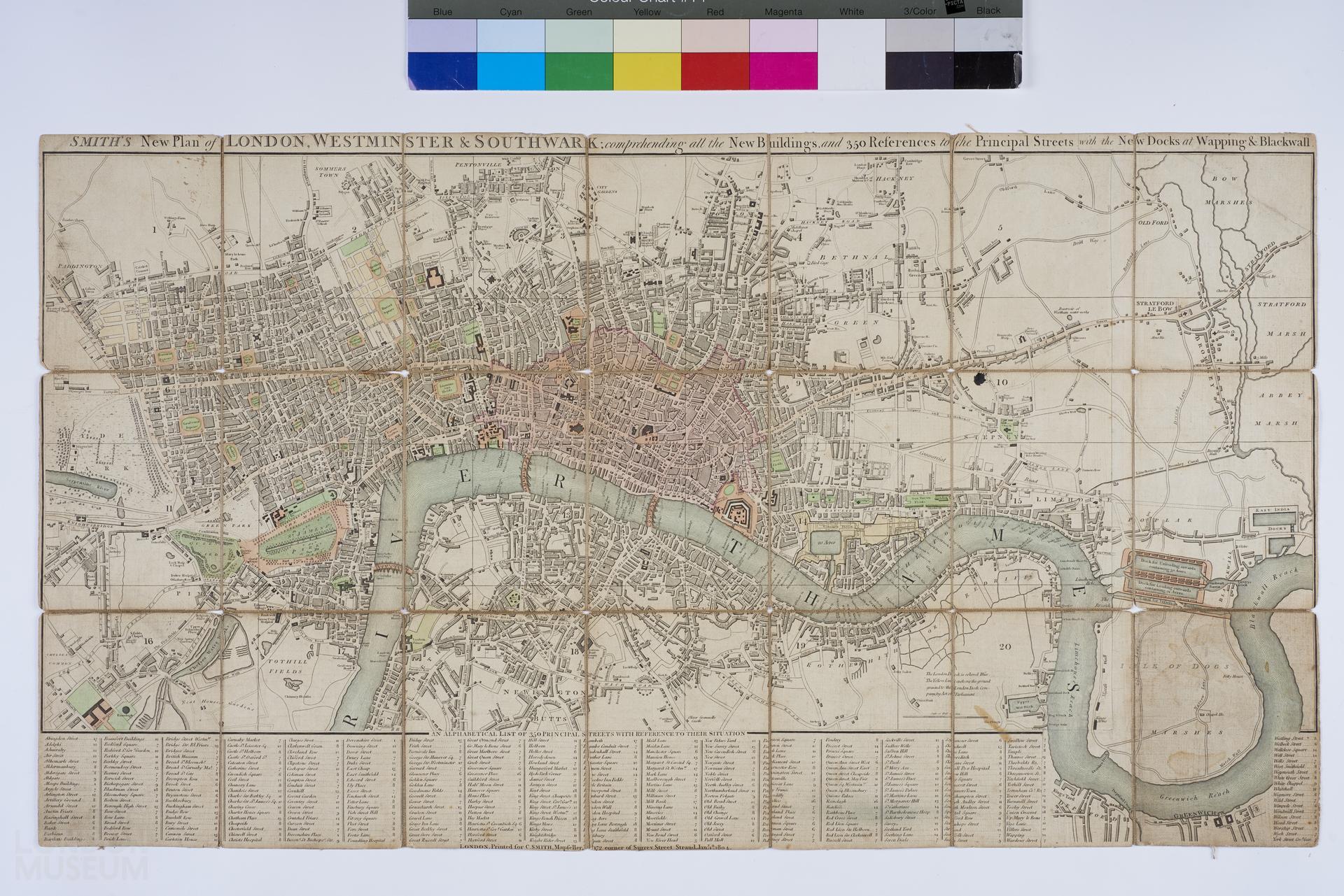
SMITH'S New Plan of LONDON, WESTMINSTER & SOUTHWARK; comprehending all the New Buildings, and 350 References to the Principal Streets with the New Docks at Wapping & Backwall
Map of London, Westminster and Southwark by Charles Smith, 1804. Looks like second edition (1st being 1801), but the date does not match, see Darlington & Howgego, 'Printed Maps of London c. 1553-1850'. Folding map, some colour, mounted on linen. Title: 'SMITH'S New Plan of LONDON, WESTMINSTER & SOUTHWARK; comprehending all the New Buildings, and 350 References to the Principal Streets with the New Docks at Wapping & Backwall'. Extent: Pentonville, Limehouse, Newington Butts and Knightsbridge.
- Category:
- Library
- Object ID:
- 83.436
- Object name:
- SMITH'S New Plan of LONDON, WESTMINSTER & SOUTHWARK; comprehending all the New Buildings, and 350 References to the Principal Streets with the New Docks at Wapping & Backwall
- Object type:
- Artist/Maker:
- Smith, Charles
- Related people:
- Related events:
- Related places:
- Production date:
- 1804
- Material:
paper, linen, ink
- Measurements/duration:
- H 415 mm, W 744 mm (overall)
- Part of:
- —
- On display:
- —
- Record quality:
- 60%
- Part of this object:
- —
- Owner Status & Credit:
Permanent collection
- Copyright holder:
digital image © London Museum
- Image credit:
- —
- Creative commons usage:
- CC BY-NC 4.0
- License this image:
To license this image for commercial use, please contact the London Museum Picture Library.
Download image file
You are welcome to download and use this image for free under Creative Commons Licence CC BY-NC 4.0.
Credit: London Museum
To licence this image for commercial use please contact the London Museum Picture Library