
Library — 1809
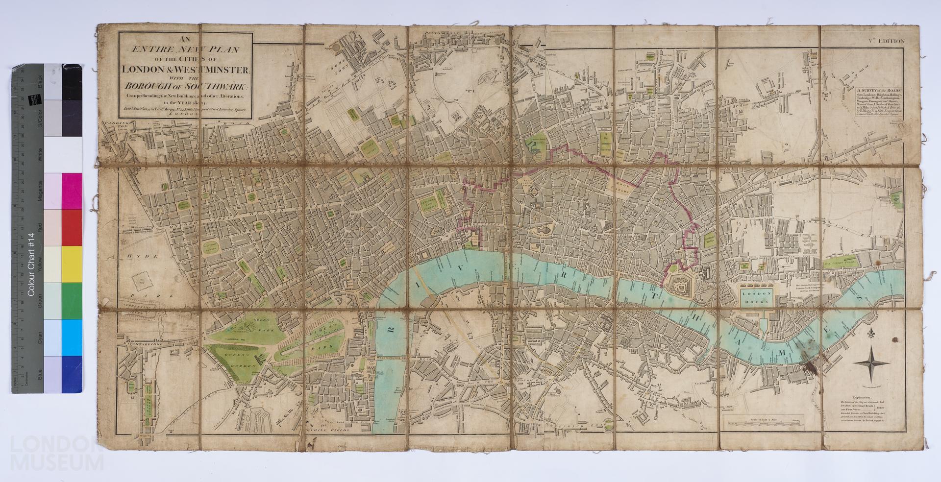
AN ENTIRE NEW PLAN OF THE CITIES OF LONDON & WESTMINSTER; WITH THE BOROUGH OF SOUTHWARK: Comprehending the New Buildings and other Alterations to the year 1809
Plan of London by Edward Mogg, 1809. Seventh edition (1st edition 1803?), all editions after and including this one are stated to be the 5th edition). Folding map, in colour, mounted on linen. Title: 'AN ENTIRE NEW PLAN OF THE CITIES OF LONDON & WESTMINSTER; WITH THE BOROUGH OF SOUTHWARK: Comprehending the New Buildings and other Alterations to the year 1809'. Extent: Pentonville, Mile End, Lambeth and Paddington. See also 30.80 and A13019.
- Category:
- Library
- Object ID:
- 50.64
- Object name:
- AN ENTIRE NEW PLAN OF THE CITIES OF LONDON & WESTMINSTER; WITH THE BOROUGH OF SOUTHWARK: Comprehending the New Buildings and other Alterations to the year 1809
- Object type:
- Artist/Maker:
- Mogg, Edward
- Related people:
- Related events:
- Related places:
- Production date:
- 1809
- Material:
paper, ink, linen
- Measurements/duration:
- H 463 mm, W 898 m (overall)
- Part of:
- —
- On display:
- —
- Record quality:
- 60%
- Part of this object:
- —
- Owner Status & Credit:
Permanent collection
- Copyright holder:
digital image © London Museum
- Image credit:
- —
- Creative commons usage:
- CC BY-NC 4.0
- License this image:
To license this image for commercial use, please contact the London Museum Picture Library.
Download image file
You are welcome to download and use this image for free under Creative Commons Licence CC BY-NC 4.0.
Credit: London Museum
To licence this image for commercial use please contact the London Museum Picture Library