
Library — 1759
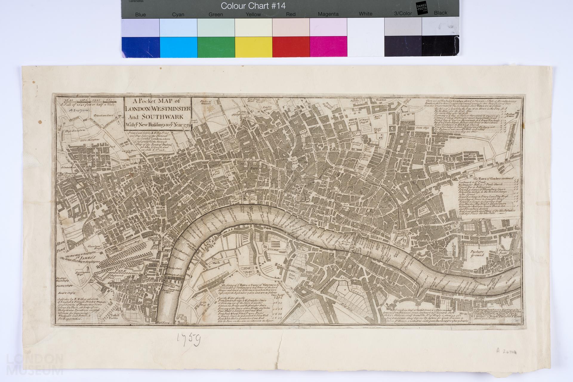
A Pocket Map of London, Westminster and Southwark with y.e New Buildings to y.e 1759
Map titled: 'A Pocket Map of London, Westminster and Southwark with y.e New Buildings to y.e 1759'. Extent: New River Head, Ratcliff, Lambeth Palace and Hyde Park. Includes table of Hackney Coach fares and watermen's fares. produced by Robert Withy.
- Category:
- Library
- Object ID:
- A24704
- Object name:
- A Pocket Map of London, Westminster and Southwark with y.e New Buildings to y.e 1759
- Object type:
- Artist/Maker:
- Withy, Robert
- Related people:
- Related events:
- Related places:
- Production date:
- 1759
- Material:
paper, ink
- Measurements/duration:
- H 247 mm, W 510 mm (overall)
- Part of:
- —
- On display:
- —
- Record quality:
- 60%
- Part of this object:
- —
- Owner Status & Credit:
Permanent collection
- Copyright holder:
digital image © London Museum
- Image credit:
- —
- Creative commons usage:
- CC BY-NC 4.0
- License this image:
To license this image for commercial use, please contact the London Museum Picture Library.
Download image file
You are welcome to download and use this image for free under Creative Commons Licence CC BY-NC 4.0.
Credit: London Museum
To licence this image for commercial use please contact the London Museum Picture Library