
Library — 1705
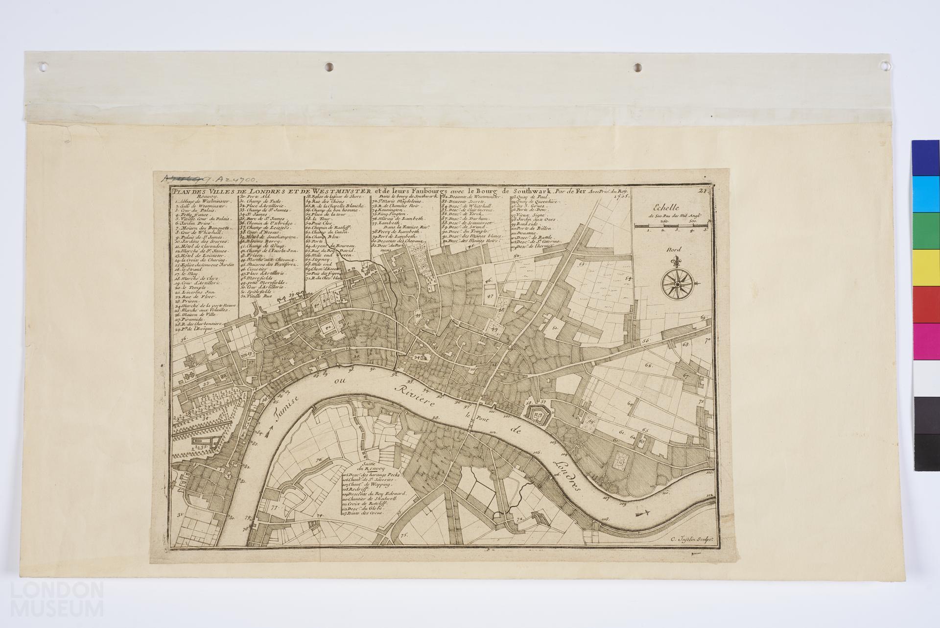
Plan des villes de Londres et de Westminster et de leurs Faubourgs avec le Bourg de Southwark
Map or plan of London, Westminster and Southwark, 1705, by Nicolas de Fer. Second edition (see A24696 for 1st edition). Title: 'PLAN DES VILLES DE LONDRES ET DE WESTMINSTER et de leurs Faubourgs avec le Bourg de Southwark'. Has numbered key to sites of interest. All text in French.
- Category:
- Library
- Object ID:
- A24700
- Object name:
- Plan des villes de Londres et de Westminster et de leurs Faubourgs avec le Bourg de Southwark
- Object type:
- Artist/Maker:
- Fer, Nicolas de
- Related people:
- Related events:
- Related places:
- Production date:
- 1705
- Material:
paper, ink
- Measurements/duration:
- H 239 mm, W 254 mm (overall)
- Part of:
- —
- On display:
- —
- Record quality:
- 60%
- Part of this object:
- —
- Owner Status & Credit:
Permanent collection
- Copyright holder:
digital image © London Museum
- Image credit:
- —
- Creative commons usage:
- CC BY-NC 4.0
- License this image:
To license this image for commercial use, please contact the London Museum Picture Library.
Download image file
You are welcome to download and use this image for free under Creative Commons Licence CC BY-NC 4.0.
Credit: London Museum
To licence this image for commercial use please contact the London Museum Picture Library