
Library — 1664-1717; 1810
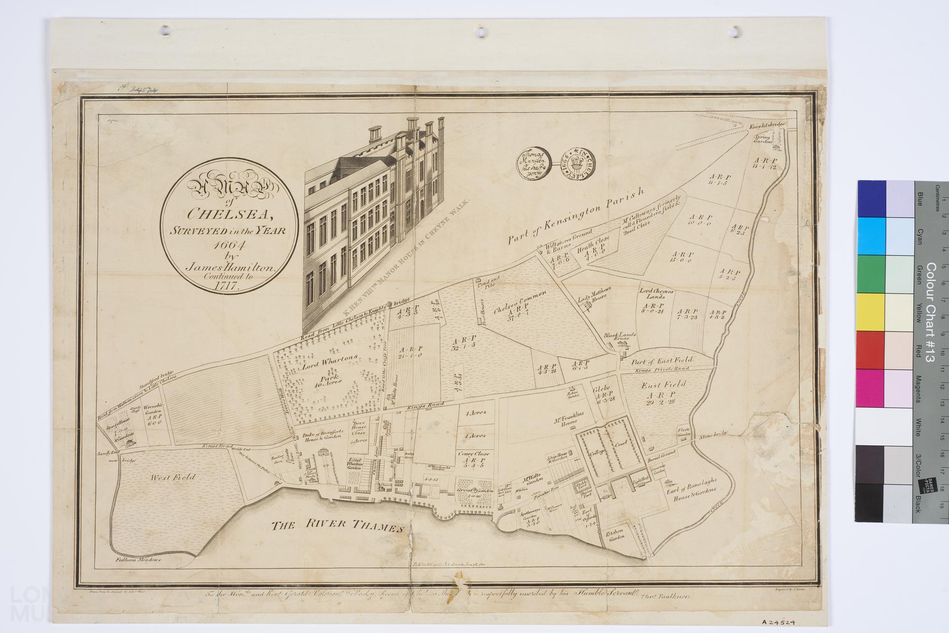
A Map of Chelsea Surveyed in the Year 1664 by James Hamilton. Continued to 1717
Map of Chelsea showing a map of the area and a partial elevation view of the 'K.Hen. VIIITH Maonor House in Cheyne Walk'. Title is 'A Map of Chelsea Surveyed in the Year 1664 by James Hamilton. Continued to 1717'. Printed in 1810. Drawn from the original by Edward Ward, engraved by J. Barlow. At the bottom of the map is the dedication: 'To the Hon.ble and Rev.d Gerald Valerian Wellesley, Rector of Chelsea, this Map (?) is respectfully inscribed by his Humble Servant, Tho.s Faulkner.' Token reads: "Thomas Munden his half penny, 1666 in Chellsey".
- Category:
- Library
- Object ID:
- A24524
- Object name:
- A Map of Chelsea Surveyed in the Year 1664 by James Hamilton. Continued to 1717
- Object type:
- Artist/Maker:
- Barlow, J., Ward, Edward
- Related people:
- Related events:
- Related places:
- Production date:
- 1664-1717; 1810
- Material:
paper, ink
- Measurements/duration:
- H 324 mm, W 460 mm (overall)
- Part of:
- —
- On display:
- —
- Record quality:
- 60%
- Part of this object:
- —
- Owner Status & Credit:
Permanent collection
- Copyright holder:
digital image © London Museum
- Image credit:
- —
- Creative commons usage:
- CC BY-NC 4.0
- License this image:
To license this image for commercial use, please contact the London Museum Picture Library.
Download image file
You are welcome to download and use this image for free under Creative Commons Licence CC BY-NC 4.0.
Credit: London Museum
To licence this image for commercial use please contact the London Museum Picture Library