

Library — 1733
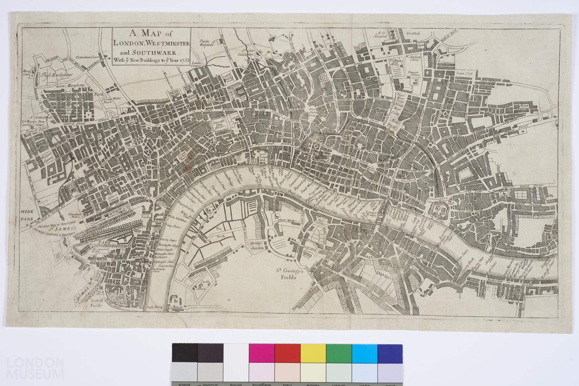
A Map of London, Westminster and Southwark. With y.e New Buildings to y.e Year 1733
Map of London, Westminster and Southwark, 1733, by Robert Seymour, pseud. (i.e. John Mottley). Title: ' A Map of London, Westminster and Southwark. With y.e New Buildings to y.e Year 1733'. Extent: Hoxton, Wapping, Lambeth and Hyde Park.
- Category:
- Library
- Object ID:
- A14372
- Object name:
- A Map of London, Westminster and Southwark. With y.e New Buildings to y.e Year 1733
- Object type:
- Artist/Maker:
- Seymour, Robert
- Related people:
- Related events:
- Related places:
- Production date:
- 1733
- Material:
paper, ink
- Measurements/duration:
- H 280 mm, W 495 mm (overall)
- Part of:
- —
- On display:
- —
- Record quality:
- 60%
- Part of this object:
- —
- Owner Status & Credit:
Permanent collection
- Copyright holder:
digital image © London Museum
- Image credit:
- —
- Creative commons usage:
- CC BY-NC 4.0
- License this image:
To license this image for commercial use, please contact the London Museum Picture Library.
Download image file
You are welcome to download and use this image for free under Creative Commons Licence CC BY-NC 4.0.
Credit: London Museum
To licence this image for commercial use please contact the London Museum Picture Library