
Library — C. 1800
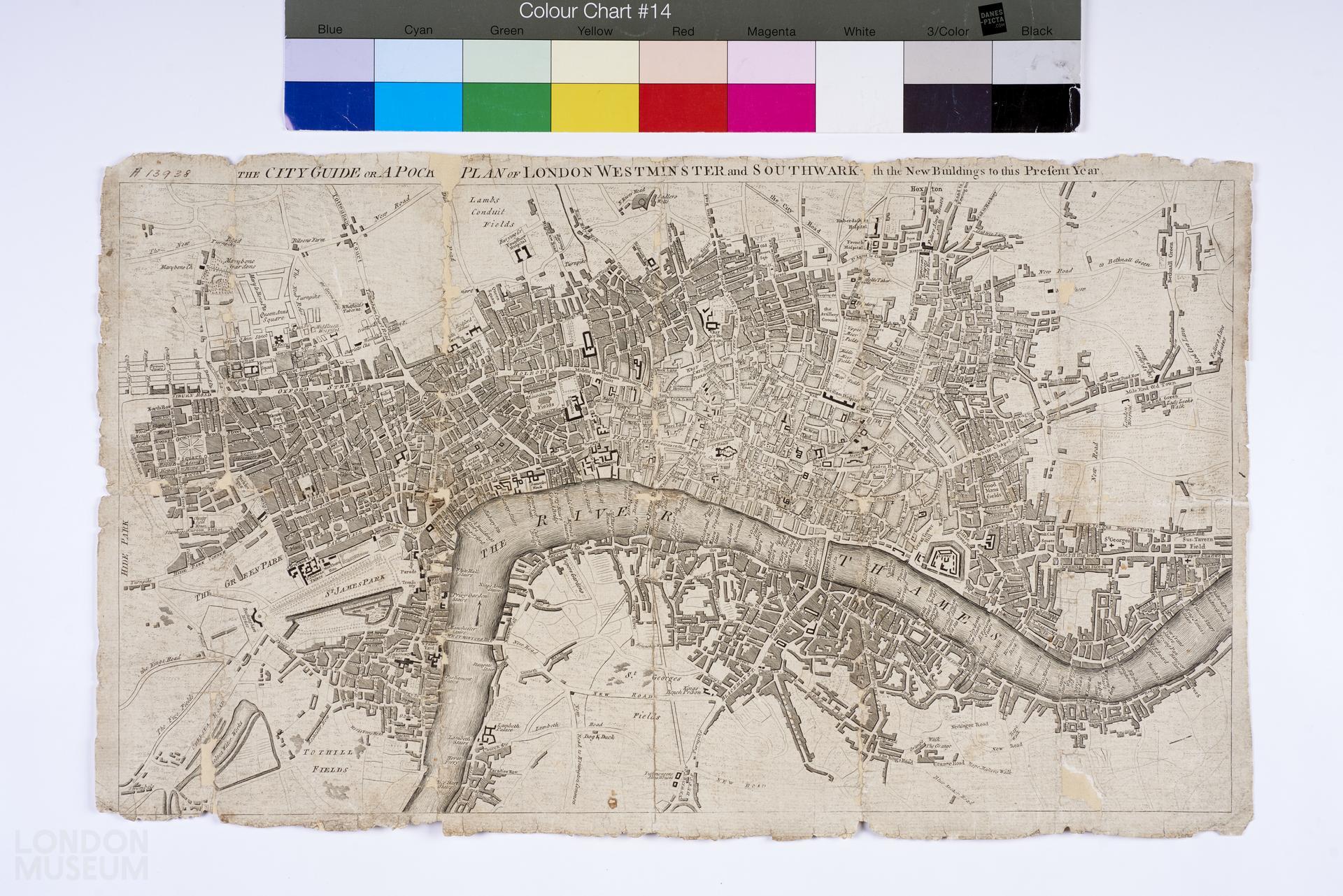
The City Guide or a Pocket Plan of London, Westminster and Southwark with the New Buildings to this Present Year
Map, a pocket plan of London, Westminster and Southwark'. Circa 1800. Title: 'The City Guide or a Pocket Plan of London, Westminster and Southwark with the New Buildings to this Present Year'. Extent: Mile End Old town, Lambeth Palace, Hyde Park and Sadler's Wells.
- Category:
- Library
- Object ID:
- A13938
- Object name:
- The City Guide or a Pocket Plan of London, Westminster and Southwark with the New Buildings to this Present Year
- Object type:
- Artist/Maker:
- —
- Related people:
- Related events:
- Related places:
- Production date:
- c. 1800
- Material:
paper, ink
- Measurements/duration:
- H 305 mm, W 515 mm (overall)
- Part of:
- —
- On display:
- —
- Record quality:
- 60%
- Part of this object:
- —
- Owner Status & Credit:
Permanent collection
- Copyright holder:
digital image © London Museum
- Image credit:
- —
- Creative commons usage:
- CC BY-NC 4.0
- License this image:
To license this image for commercial use, please contact the London Museum Picture Library.
Download image file
You are welcome to download and use this image for free under Creative Commons Licence CC BY-NC 4.0.
Credit: London Museum
To licence this image for commercial use please contact the London Museum Picture Library