
Library — 1815
An Entire New Plan of the Cities of London & Westminster, with the Borough of Southwark
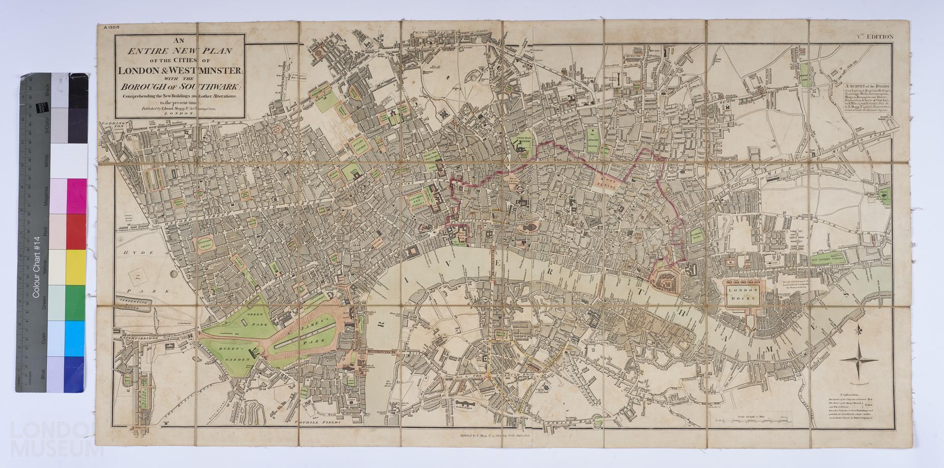
A plan of London, titled ‘An Entire New Plan of the Cities of London & Westminster, with the Borough of Southwark: Comprehending the New Buildings and other Alternations, to the present time’. Published by Edward Mogg, at No. 51, Charing Cross, London. Folding map, in colour, mounted on linen. Fifth edition (according to the printed content). Extent: Pentonville, Mile End, Lambeth and Paddington. See also 50.64 and 30.80. Notes on the white label adhered to the melinex sheet reads, ‘1815 Mogg (11th edition? Of 1803?)’. Information from previous Content description, ‘May be eleventh edition of 1803? map, however date does not match that edition (see Darlington & Howgego, 'Printed Maps of London c. 1553-1850').’.
- Category:
- Library
- Object ID:
- A13019
- Object name:
- An Entire New Plan of the Cities of London & Westminster, with the Borough of Southwark
- Object type:
- Artist/Maker:
- Mogg, Edward
- Related people:
- Related events:
- Related places:
- Production date:
- 1815
- Material:
paper, ink, linen
- Measurements/duration:
- H 473 mm, W 900 mm (overall)
- Part of:
- —
- On display:
- —
- Record quality:
- 60%
- Part of this object:
- —
- Owner Status & Credit:
Permanent collection
- Copyright holder:
digital image © London Museum
- Image credit:
- —
- Creative commons usage:
- CC BY-NC 4.0
- License this image:
To license this image for commercial use, please contact the London Museum Picture Library.
Download image file
You are welcome to download and use this image for free under Creative Commons Licence CC BY-NC 4.0.
Credit: London Museum
To licence this image for commercial use please contact the London Museum Picture Library