

Library — 1762
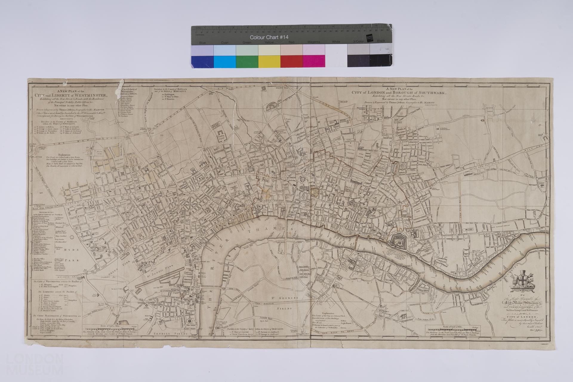
A new plan of the city and liberty of Westminster ... the City of London and Borough of Southwark, exhibiting all the new streets, roads, &c. not extant in any other plan
Plan of London, Westminster and Southwark, 1762, by Thomas Jeffreys. Second edition (first edition also 1762). Title: 'A new plan of the city and liberty of Westminster ... the City of London and Borough of Southwark, exhibiting all the new streets, roads, &c. not extant in any other plan'. Extent: Islington, Stepney Church, Newington Butts and Paddington. Combination of two maps. Printed for Robert Sayer, at No. 53 in Fleet Street; Thos. Jefferys, at the Corner of St Martin's Lane in the Strand; and Carrington Bowles, at No. 69 in St Paul's Church Yard. Dedicated to "The right honourable the Lord Mayor Alderman and Commissioners of the Sewers Lamps and Pavements for the City of London".
- Category:
- Library
- Object ID:
- A1875
- Object name:
- A new plan of the city and liberty of Westminster ... the City of London and Borough of Southwark, exhibiting all the new streets, roads, &c. not extant in any other plan
- Object type:
- Artist/Maker:
- Jefferys, Thomas
- Related people:
- Related events:
- Related places:
- Production date:
- 1762
- Material:
paper, ink
- Measurements/duration:
- H 476 mm, W 933 mm (overall)
- Part of:
- —
- On display:
- —
- Record quality:
- 60%
- Part of this object:
- —
- Owner Status & Credit:
Permanent collection
- Copyright holder:
digital image © London Museum
- Image credit:
- —
- Creative commons usage:
- CC BY-NC 4.0
- License this image:
To license this image for commercial use, please contact the London Museum Picture Library.
Download image file
You are welcome to download and use this image for free under Creative Commons Licence CC BY-NC 4.0.
Credit: London Museum
To licence this image for commercial use please contact the London Museum Picture Library