
Library — 1747
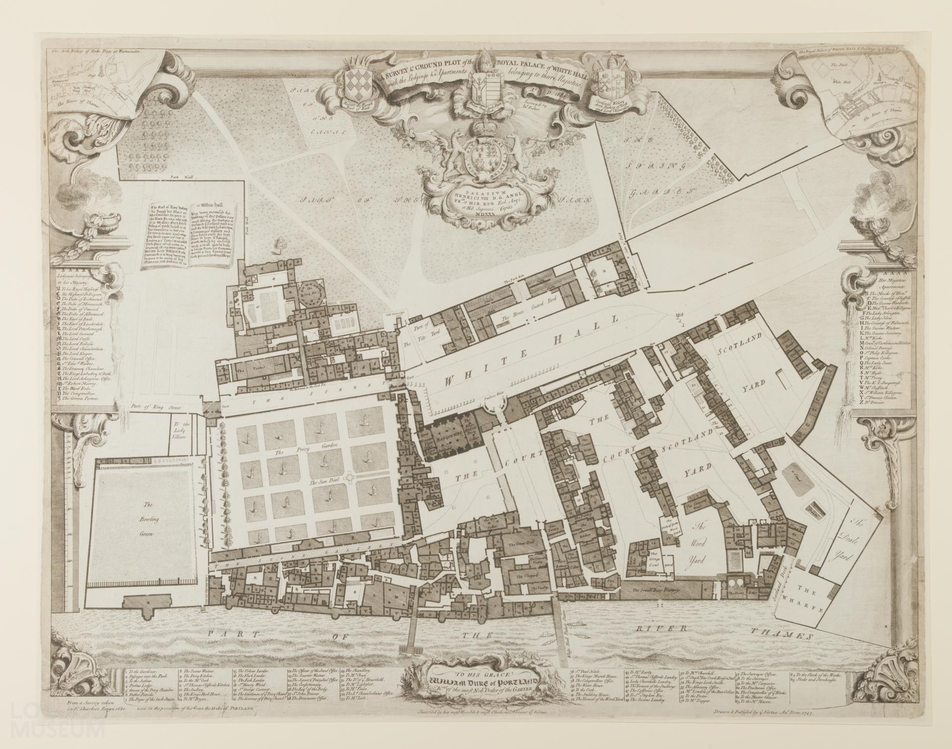
A Survey & Ground Plot of the Royal Palace of Whitehall
Map drawn and published by George Vertue in 1747, based on a survey taken in King Charles's reign, 1680, owned by the Duke of Portland, to whom Vertue has dedicated the map engraving. Published in Vetusta Monumenta (1747-1835) No 63.
- Category:
- Library
- Object ID:
- NN20158
- Object name:
- A Survey & Ground Plot of the Royal Palace of Whitehall
- Artist/Maker:
- Vertue, George
- Related people:
- Related events:
- Related places:
- Production date:
- 1747
- Material:
paper, ink
- Measurements/duration:
- H 564 mm, W 729 mm (paper)
- Part of:
- —
- On display:
- —
- Record quality:
- 60%
- Part of this object:
- —
- Owner Status & Credit:
Permanent collection
- Copyright holder:
digital image © London Museum
- Image credit:
- —
- Creative commons usage:
- CC BY-NC 4.0
- License this image:
To license this image for commercial use, please contact the London Museum Picture Library.
Download image file
You are welcome to download and use this image for free under Creative Commons Licence CC BY-NC 4.0.
Credit: London Museum
To licence this image for commercial use please contact the London Museum Picture Library