10 historical maps of London
In the 21st century, maps have turned from paper to pixels, becoming interactive and automatically updated. The amazing variety of historic maps in our collection show how people have long found innovative ways to map the city, helping Londoners navigate it, understand it and marvel at it.

The Copperplate map, around 1559
This is the earliest map of London to have survived. No printed versions remain, just three of the 15 copper plates used to print it. We have two here at the museum. This section shows the suburban area north of the city wall – at this time home to windmills and open fields, where women are shown washing and bleaching clothes, and archers practice their aim.

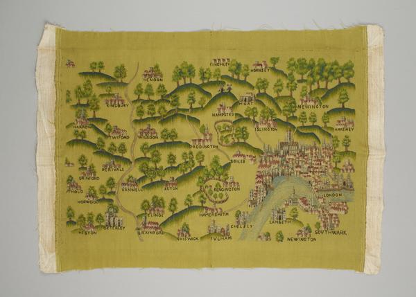
The Sheldon tapestry map, 1590s
This 19th-century tapestry is a copy of one from the 1590s, when Queen Elizabeth I ruled England. The original was woven from wool and silk and hung in the house of the wealthy antique collector Ralph Sheldon. He had four tapestry maps, each showing English counties. London appears in the bottom right of the map of Oxfordshire, which again shows just how rural Greater London was at this time.
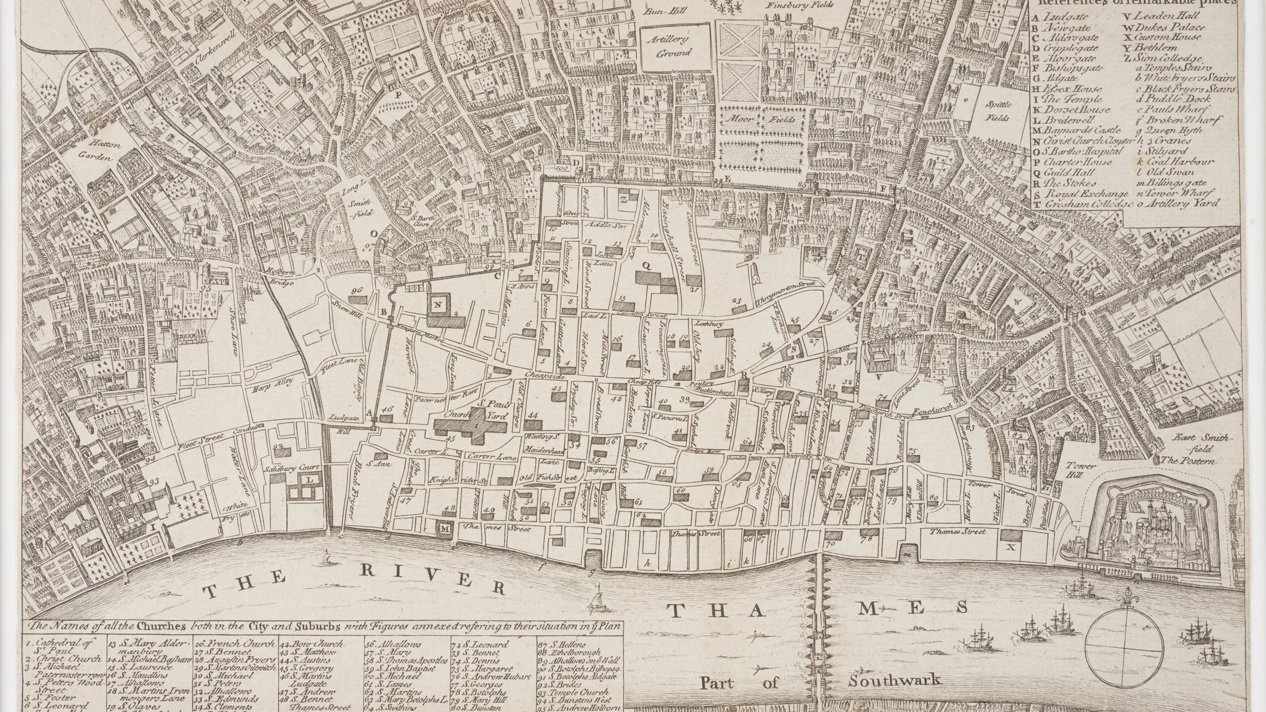
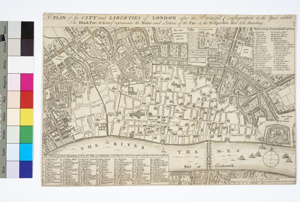
London after the Great Fire, 1666–1667
This engraving is based on Wenceslaus Hollar’s map of London showing the destruction caused by the 1666 Great Fire. The fire destroyed four fifths of what we now call the City of London, stretching across an area from the Tower of London to Fetter Lane. Grand plans for the city followed, but it was largely rebuilt along the same streets.

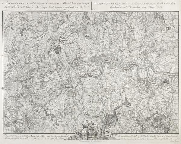
A map of London and the adjacent Country 10 Miles Round, 1746
This 1748 version of John Rocque’s 10 Miles Round map offers a rare view of London’s outer boroughs. They bustle with urban life today, but in 1746, they weren’t touched by the city’s spread. Still, London expanded hugely in the 18th century. Building booms saw the city grow north, east, south and west. A ring of Georgian suburbs began to surround the City and Southwark.

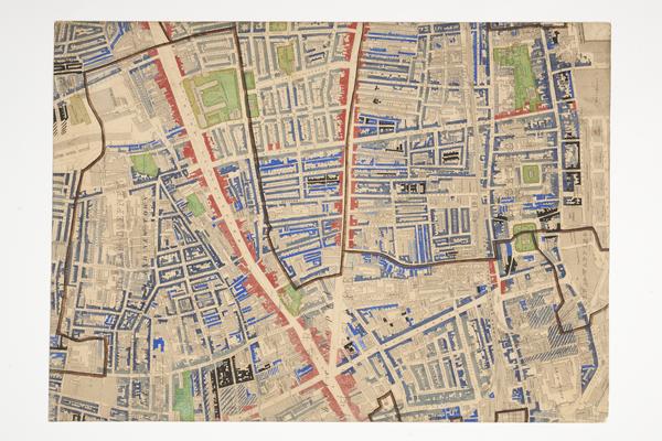
Charles Booth’s Descriptive Map of London Poverty, 1889
In 1890, Victorian London became a city of over four million people. But this was a metropolis that struggled to provide for its people. In the late 1880s and 1890s, businessman Charles Booth funded a landmark geographical study of living conditions that found 30.7% of Londoners were living in poverty. Booth’s map showed the poorest areas in blue and black, such as Spitalfields and Whitechapel, shown here.

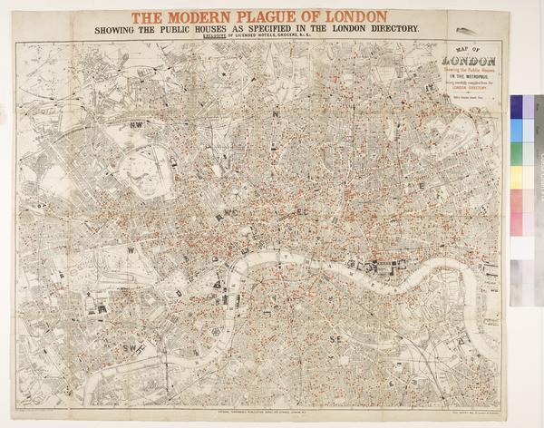
The Modern Plague of London, 1886
This map has nothing to do with disease – it’s actually a map of pubs in London. It was published by the National Temperance League, a group who argued against drinking alcohol. Whether you’re for or against them, pubs remain part of London’s cultural fabric today, just as they have been for centuries.

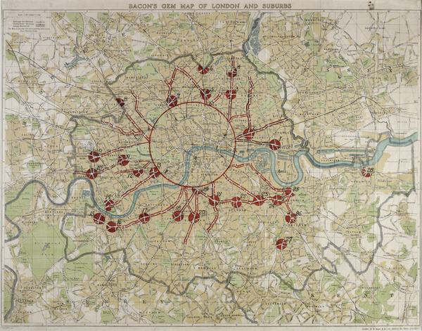
Bacon’s Gem Map of London and Suburbs, 1920s
London’s suburbs swelled during the interwar period of 1918 to 1939, roughly doubling the size of the city. Places like Dagenham and Hendon exploded as new developments sprung up to take advantage of the local rail connections. North London’s suburbs became known as ‘Metroland’, while the Green Belt Act was introduced in 1939 to stem the city’s growth into the countryside. The red lines on this map show major roads.
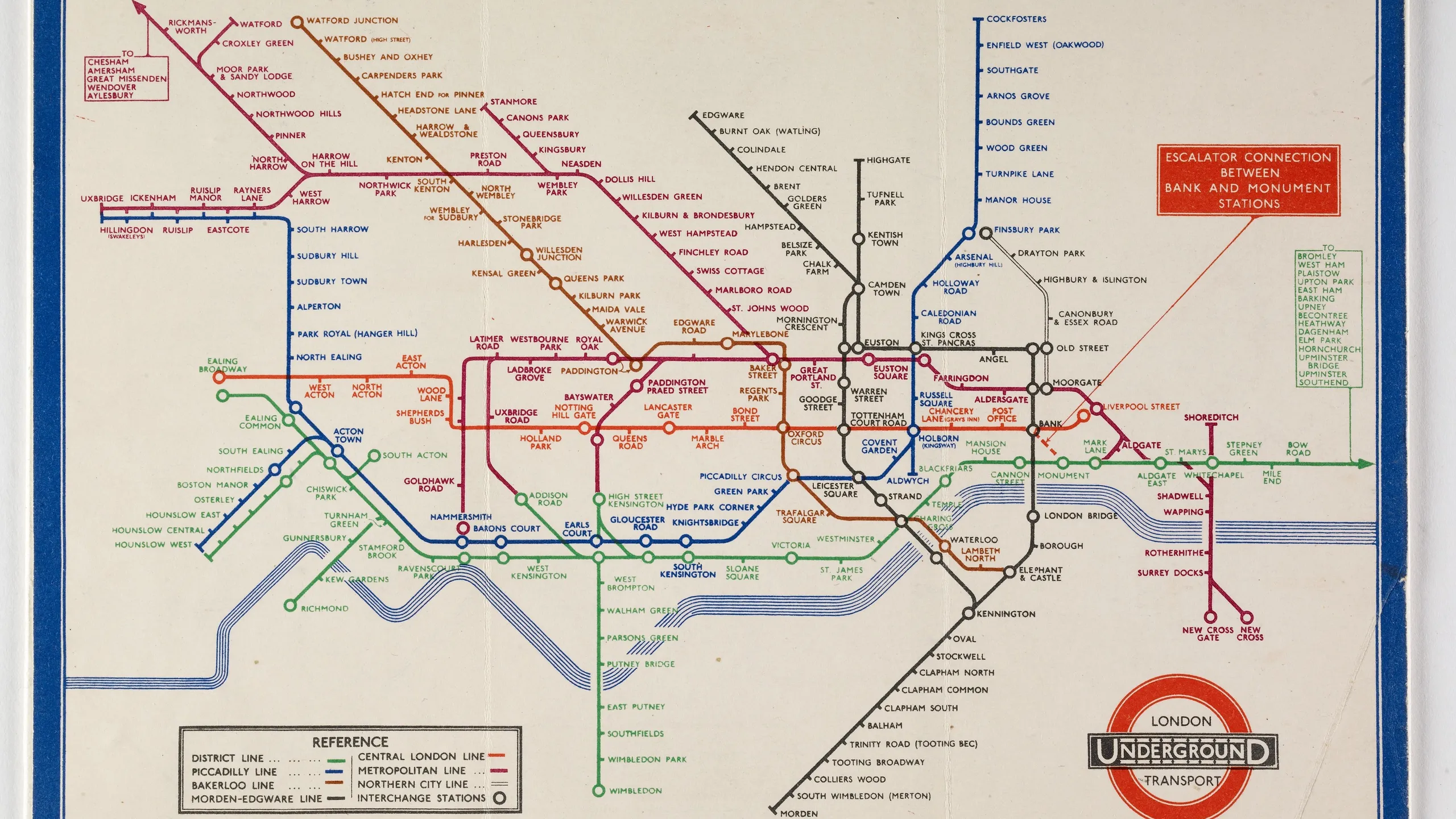
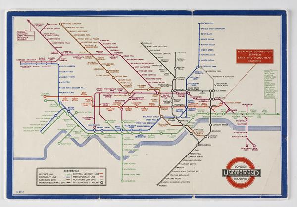
The London Underground, 1933
It might not be much use for getting around above ground, but the clear and efficient design of Harry Beck’s 1935 London Underground map has stood the test of time. Today’s map features more lines and stations, but continues to use the same iconic style, which was originally based on an electrical circuit diagram.

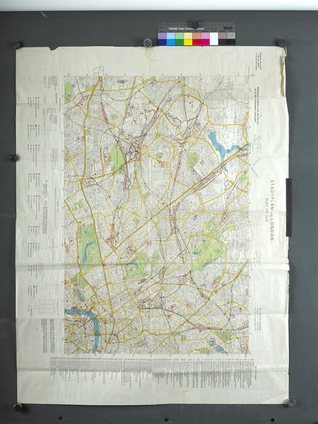
Stadtplan von London, 1941
Not everyone who used maps to navigate London explored it with good intentions. This street map was adapted by the German air force, the Luftwaffe, to help bomber pilots find their targets during the Blitz. Red and purple markings indicate targets, while the key lists them individually. Stations and factories appear alongside museums and universities.

The birth of Greater London, 1965
This Post Office map was used by telephone engineers. It shows the 32 new London boroughs that were created along with the Greater London Council (GLC) in 1965. With the creation of the GLC, London adopted areas that were previously part of Surrey, Essex, Kent, Middlesex and Hertfordshire. This official expansion formed the enormous, sprawling city we know today.
Tags
-
-
Library
 Library
A plan of the City and Liberties of London after the dreadful conflagration in the year 1666 (map)
Hollar, Wenceslaus
1756
-
-
-
-
Printed Ephemera
-
-
-
Library
 Library
Englands glory or the glory of England being a new mapp of the Citty of London (map)
Walton, Robert
1676